Cirque of the Towers Traverse
⬇ GPX / track⚠ unverified🚐 Join the caravan
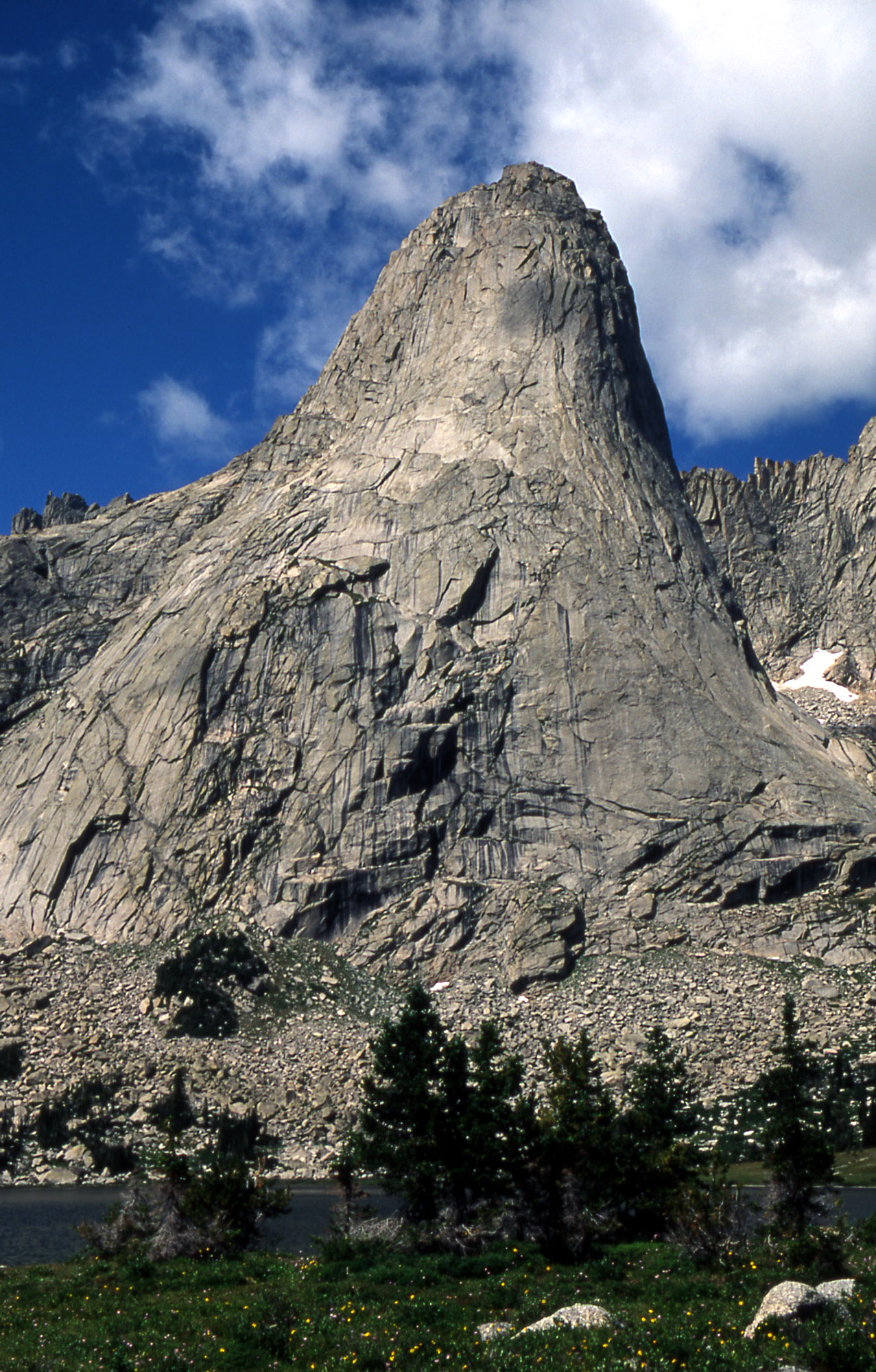
An alpine rock traverse of the major towers in WY's Wind River Range, from Pingora to Warbonnet — ~11 towers, 4th to low-5th class with harder route options. 9-mi approach from Big Sandy, multi-day. Pre-dawn starts to beat afternoon lightning; full grizzly country.
🚗 Getting there & comms
Trailhead: Big Sandy Trailhead
~40mi of dirt off the Boulder/Pinedale side. Slow, washboarded — protect the undercarriage from salt-seeking porcupines.
🗺️ Google Maps directions⛽ Last services: Pinedale, WY (~50 mi northwest via Hwy 191 then forest roads): last reliable gas, grocery, and restaurant. Boulder, WY (a small hamlet ~40 mi out) has very limited services. The 40-mi dirt road to Big Sandy has no services. Last cell signal: Pinedale (AT&T and Verizon). Cell drops entirely within a few miles of leaving pavement.
📶 Cell signal: Verizon offers the most coverage in the Wind River Range but is still unreliable — best from exposed ridgelines with open views east toward the high plains. AT&T has coverage in Pinedale and drops quickly on the approach. Last reliable signal: Pinedale, WY. No cell service at Big Sandy TH or in the Cirque. Carry a satellite communicator (InReach/SPOT) — this is mandatory, not optional.
🧗 Routes
🎒 Gear & food
Rack: Light single rack to #3 (some carry doubles 0.2-1) + a set of nuts. Minimize weight for the traverse.
Ropes: Single 70m, or 60m doubles. Skinny ~8.9-9mm to save weight; a single 60m covers the raps.
Footwear: Trail runners / approach shoes for the 9-mi approach and much of the 4th class; rock shoes for the harder pitches. Early season the passes hold snow — light microspikes optional. No mountain boots mid-summer.
🪓 Mountaineering: Helmet; light microspikes for snowy passes early season — no crampons mid-summer.
Glacier: None — pure alpine rock. Save glacier-travel + crevasse-rescue kit for Glacier NP / the Cascades.
🍫 Food: 2-3 day alpine push — ~3,000-3,500 kcal/day, calorie-dense + a stove.
🩹 Med/repair kit: Gauze pads + medical tape · Athletic tape (blister prevention on long approach, flappers) · SAM splint (ankle on talus/boulder approach) · Ibuprofen 200 mg tabs (AMS headache, general) · Acetazolamide (Diamox) — Rx, strongly recommended for sea-level to 10,000+ ft trip · Blister care (moleskin, Compeed — 9-mile approach each way) · Electrolyte tabs/salt caps (altitude + exertion) · Sunscreen SPF 50+ + SPF lip balm · Water filter (pump or squeeze — treat all backcountry sources) · Emergency bivy sack · Headlamp + spare batteries · Nitrile gloves x2 · Ace bandage / compression wrap · Dental floss + needle (gear repair, improvised) · Bear canister is required (also doubles as emergency seat/stool)
🪢 Skills needed
- Simul-climbing / moving together on 4th-low-5th
- Kiwi coil and short-roping
- Efficient multi-rappel management — carry tat/cordelette to back up loose stations
- Alpine route-finding
- Pre-dawn starts to beat afternoon lightning
⏰ Start & altitude
🌄 Timing: Mid-July: sunrise ~5:30 AM, sunset ~8:50 PM (MDT, lat 42.8°N, approx.). Alpine/remote objective — camp at Lonesome Lake (~10,200 ft) the night before. Start climbing by 7–8 AM from camp. Be off summits by 11:30 AM–noon — Wind River thunderstorms build fast and hit hard by early afternoon. Lightning exposure is extreme on the tower tops; bail threshold is low.
🫁 Altitude & sun: Big Sandy Trailhead: ~9,100 ft. Lonesome Lake camp: ~10,200 ft. Pingora summit: ~11,884 ft. Multi-day backcountry approach (~9 miles). CRITICAL for Austin-based climber: you start at sea level, gain 9,000+ ft in one or two days of driving/hiking — AMS risk is HIGH. Plan 1–2 nights at 7,000–8,000 ft (Pinedale or Jackson area) before going in. Symptoms: headache, fatigue, nausea, poor sleep — descend if worsening. Hydrate 3+ L/day. UV at 12,000 ft is severe — SPF 50+, sun hoody, quality sunglasses required. Dry air at altitude accelerates dehydration; keep drinking even when not thirsty.
✅ Before you leave the trailhead
Auto-built from this dossier — ticks save on this device.
🏕️ Land · camp · water · permits
🪧 Land & passes: Bridger-Teton National Forest (Bridger Wilderness) and Shoshone National Forest (Popo Agie Wilderness). No fee, no permit required for groups under 15. Self-issue wilderness registration at some trailheads (informational). No entrance fee; no America the Beautiful pass required for access. Big Sandy Campground ~$7/night.
🔥 Campfires: No campfires — alpine zone, stove only. The Cirque of the Towers sits within Bridger Wilderness (Bridger-Teton National Forest) where campfires are prohibited above 10,000 ft and within 200 ft of lakes/streams. The Cirque is entirely above 10,200 ft — bring a canister stove. Bear canister required.
🆓 Free camping nearby:
- Big Sandy Campground (7 sites, $7/night, first-come) the night before the approach
- Big Sandy Reservoir area — BLM dispersed camping on the approach road near Farson/Boulder WY
- Inside the wilderness: camp anywhere — 200 ft from water, 100 ft from streams; no camping within 1/4 mi of Lonesome Lake; no fee in wilderness zones
- Town of Boulder WY (44 mi south) — very small; Pinedale WY (50+ mi) for motel options
Camp:
- Big Sandy Campground the night before ($7, first-come)
- Benches/meadows ABOVE Lonesome Lake — NO camping within 1/4 mi of Lonesome Lake
- Keep 200ft from lakeshores, 100ft from streams
- Big Sandy Lake / Arrowhead Lake on the approach
💧 Water: No potable water at Big Sandy trailhead — arrive full · Filter/treat ALL water (giardia) · Abundant streams and lakes in the basin
📋 Permits: None for Bridger/Popo Agie Wilderness (groups under 15, no fee). Tribal permit only if you enter the Wind River Indian Reservation. Big Sandy Campground $7/night.
🚽 Toilet: Vault toilets at Big Sandy trailhead. Backcountry: WAG bag or cathole 200ft from water, pack out TP — no facilities in the Cirque.
⚠️ Hazards · fire · emergency
- Afternoon thunderstorms/lightning — off summits by ~1pm
- Loose rock + unreliable rappel anchors
- Altitude 10-12k+
- Long committing 9-mi approach / multi-day
- Grizzly and black bears
Grizzly + black bear country — bear spray on hip + approved canister/Ursack required. Brutal mosquitoes mid-June to July (head net + DEET). Marmots chew gear straps. Wildflowers peak in July.
🔥 Fire & smoke: Wyoming/Wind River Range fire risk is moderate compared to the drier Southwest, but smoke from fires across the West routinely impacts summer visibility and air quality (July–September). The Cirque itself is at high elevation (10–12k ft) and less prone to fire starts than the surrounding lower forest. In 2021 a wildfire impacted access roads west of Pinedale. Check InciWeb Wyoming and NIFC forecasts. Campfires restricted in the wilderness during high fire danger — always use a stove.
🪂 Bail / retreat: Pingora descent: rap the South Buttress bolted descent (~3 rappels, single 70m rope works with some easy downclimbing between stations; or 2 ropes for comfort). East Ledges (4th class with a rap or two) is the alternative. Route becomes fully committing above pitch 5–6 on the East Face — build gear anchors and retreat if needed. Once you leave Lonesome Lake for the towers, you are 9+ trail miles from the trailhead. If weather deteriorates, retreat to camp and wait — do not push summit in electrical weather. Traverse links multiple towers; bail is harder mid-traverse; have a plan at each col.
🆘 Emergency contacts
- Emergency — Dial 911
- Sublette County Sheriff (non-emergency) (307) 367-4378 — Pinedale, WY; Cirque of Towers is in Sublette County
- Tip Top Search & Rescue (Sublette County) (307) 367-2849 — Volunteer SAR; helicopter staged ~12 min from Cirque when conditions allow. Dispatched through 911.
- Sublette County Hospital District (ER) (307) 367-0099 — 615 E. Hennick St, Pinedale, WY — 24hr emergency; serious trauma may transport to Jackson or Rock Springs
🌤️ Live conditions
Auto-updated 12h ago · °F · tap a link for the mountain-specific picture ↓
🦟 Peak mosquitoes mid-June to late July; eases through August — best bug window late Aug-Sept.
👀 In the field
Tap any for ID, edibility & first-aid.
🏛️ Access · ranger · pass
Ranger station: Pinedale Ranger District (Bridger-Teton NF) — (307) 367-4326; 29 E. Fremont Lake Rd, Pinedale, WY 82941. Open Mon–Fri 8 am–4:30 pm. Bear canisters rentable here.
Pass: No entry fee for Bridger Wilderness; camping is first-come at the Cirque (no reservation). Self-issue permit at Big Sandy Trailhead. Bear canister required.
Official page ↗🎣 Fishing
Excellent fishing throughout the Cirque basin and approach lakes. Big Sandy Lake, Arrowhead Lake, and the Lonesome Lake area hold brook trout, cutthroat, and some grayling. Wyoming fishing license required (purchase from Wyoming Game & Fish online or in Pinedale). High alpine lakes are typically ice-free and fishable July–September. Fly fishing only in some designated stretches — check Wyoming Game & Fish regulations for Sublette County waters.
🔭 Points of interest
Fire lookouts, old mines, wreckage, historic relics nearby.
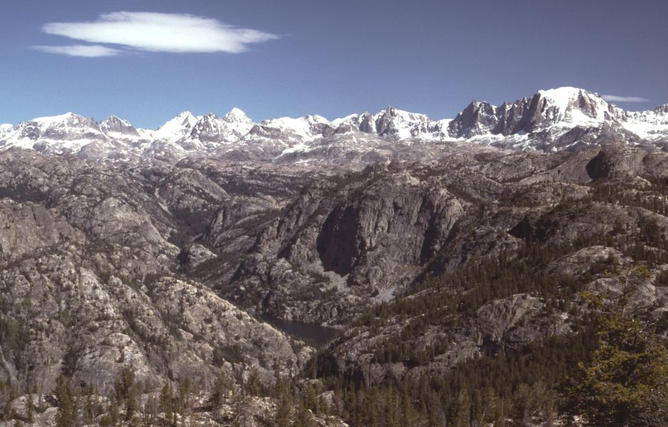
- Lizard Head Peak (12,842 ft) — The best viewpoint in the Cirque — non-technical scramble to the summit with unobstructed 360° views of all the towers. Classic objective for the rest day.
- Sinks Canyon State Park — ~60 mi east near Lander, WY — the Popo Agie River disappears into a limestone cavern then resurfaces downstream. Surreal geology + free to visit.
- Big Sandy Lake — Beautiful basecamp lake at the end of the main approach trail — good swimming and fishing in late summer.
- Continental Divide / Jackass Pass — Jackass Pass on the Cirque traverse gives access to the Continental Divide and views into multiple drainages.
📍 Nearby & other interest
- Lizard Head Peak (12,842') — scramble + the best Cirque views
- Shark's Nose, Block Tower, Mitchell Peak — more towers
- Lonesome Lake
- The 45-mi Cirque loop via Texas & Washakie passes
- Big Sandy Lake — basecamp + a swim
💬 Comments
Comments are reviewed before they show up.