Shoshone Spire (South Face)
🚐 Join the caravan
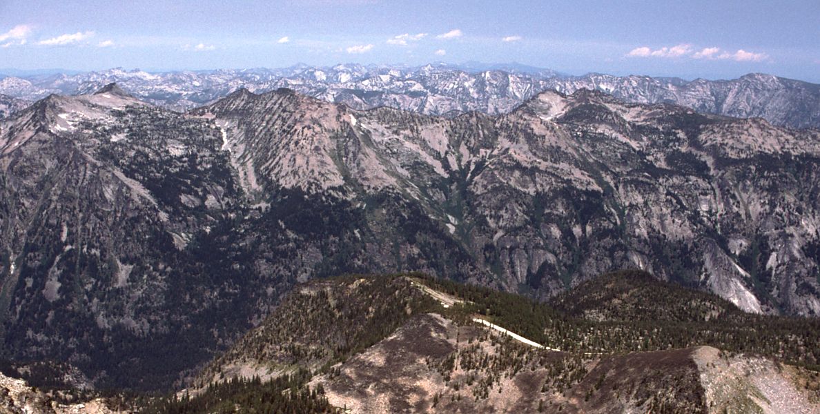
A granite spire on the ID/MT border in the Selway-Bitterroot Wilderness — think Yosemite-scale crack systems on an alpine stage, with a fraction of the crowds. The South Face offers 6-7 pitches to ~5.8 on a mix of granite and metamorphic rock. The approach (~4.5 mi) from an east-side Bitterroot NF trailhead (Bass Creek, Lost Horse Creek, or similar off US-93) involves creek crossings and brushy drainages with real route-finding. Less online beta exists for this objective than for Front Range or Sierra classics — verify current conditions and route details with Missoula-area shops (Pipestone Mountaineering) or the Bitterroot Outdoor Project before committing.
🚗 Getting there & comms
Trailhead: Blodgett Creek Trailhead
Just W of Hamilton, MT via Blodgett Canyon Rd — good gravel to the TH.
🗺️ Google Maps directions⛽ Last services: Hamilton, MT (~6 mi east of Blodgett TH on Hwy 93): last full gas, grocery (Albertsons), restaurants, Bitterroot Brewing. Stevensville, MT (~15 mi north on US-93) also has gas and limited services. Cell signal (AT&T and Verizon) is solid in Hamilton and along US-93 corridor. Signal fades once you turn onto the gravel canyon road and drops to zero by 1–2 mi into the canyon.
📶 Cell signal: AT&T and Verizon solid in Hamilton, MT. Signal degrades quickly on the gravel canyon approach road and is absent in Blodgett Canyon itself and at the climbing areas. Last reliable cell: Hamilton, MT town center. Carry a satellite communicator (InReach/SPOT) — mandatory for a remote objective with no bailout communication.

🧗 Routes
🎒 Gear & food
Rack: Single rack to #3. Doubles in hand sizes: .75, #1, #2. Full set of nuts. Light extra slings for threads/horns on the spire. No fixed protection to count on — this is not a manicured crag.
Ropes: 60m single covers the pitches. 60m doubles preferred if you want rappel flexibility — spire descents often favor raps over a summit walk-off. Bring extra cordelette/tat to back up or build anchors.
Footwear: Trail runners for the approach — you will get your feet wet at creek crossings. Rock shoes on route. Approach slabs near the base may warrant rock shoes early; a kiwi coil here saves transitions.
🪓 Mountaineering: Helmet; possible microspikes early season on the approach.
Glacier: No glacier on route. Possible snow patches on north-facing slopes in approach drainages early season (May-June). Microspikes optional pre-July if approaching a north-facing drainage.
🍫 Food: Long approach day — ~3,000 kcal, calorie-dense + plenty of water.
🩹 Med/repair kit: Gauze pads + medical tape · Athletic tape (flappers on granite, ankle support on approach) · SAM splint (scramble/boulder approach) · Ibuprofen 200 mg tabs · Blister care (moleskin — 3-mile trail approach) · Skin glue or Steri-Strips · Tweezers (splinters, debris) · Antihistamine/Benadryl (wasp nests common in canyon walls) · Sunscreen SPF 50 + SPF lip balm · Electrolyte tabs · Water filter or tabs (Blodgett Creek) · Emergency space blanket · Headlamp + spare batteries · Nitrile gloves x2
🪢 Skills needed
- Solid trad lead at 5.8 — sustained crack climbing, not a one-move wonder
- Multi-pitch management: rope drag awareness, efficient transitions, anchor building on natural features
- Route-finding — no manicured park; printed topo required, check Mountain Project Bitterroot area for any updated beta
- Kiwi coil / short-rope technique for approach slabs and 4th-class sections
- Rappel management on natural and marginal anchors — inspect and back up everything
⏰ Start & altitude
🌄 Timing: Mid-July: sunrise ~5:30 AM, sunset ~9:05 PM (MDT, lat 46.2°N, approx.). Aim for a 6:00–6:30 AM start from the Blodgett Canyon TH for a comfortable day on the 7-pitch South Face. No extreme alpine timing pressure — the spire is below treeline — but afternoon convective storms roll over the Bitterroots regularly in July; plan to be descending by 2–3 PM.
🫁 Altitude & sun: Blodgett Canyon Trailhead: ~4,000 ft (Hamilton, MT). Shoshone Spire summit: ~8,000 ft (approx.). Approach: ~3 miles up-canyon on trail, then scramble to the base. Moderate altitude gain — AMS unlikely but the jump from low canyon to 8,000 ft in one day may cause mild fatigue/headache for someone coming from sea level. Hydrate well. UV is meaningful at 8,000 ft on exposed granite; SPF 50, lip balm, sunglasses recommended — north-facing aspects get less sun but the summit and upper pitches are exposed.
✅ Before you leave the trailhead
Auto-built from this dossier — ticks save on this device.
🏕️ Land · camp · water · permits
🪧 Land & passes: USDA Forest Service — Bitterroot National Forest / Selway-Bitterroot Wilderness. No entrance fee, no climbing permit, no camping permit. Self-issue wilderness permit at trailhead is informational only. No America the Beautiful pass required (National Forest / Wilderness — free access).
🔥 Campfires: Bitterroot National Forest campfire rules: fires permitted in designated rings at Blodgett Campground. Stage 1–2 restrictions common July–September during dry years; Stage 2 means stoves only, no campfires. Check current restrictions at fs.usda.gov/r01/bitterroot or mtfireinfo.org, or call Stevensville Ranger District (406) 777-5461.
🆓 Free camping nearby:
- Blodgett Campground (5 sites + 1 walk-in, FREE, first-come) — 6 mi from Hamilton, MT at the mouth of Blodgett Canyon; vault toilet, fire rings, picnic tables
- Dispersed camping throughout Bitterroot National Forest — free, 200 ft from water, 16-day max stay
- Multiple dispersed pull-offs along creek drainages off US-93 (Bass Creek, Lost Horse Creek, Sweathouse Creek) within 10–20 min of the Hamilton corridor
Camp:
- FREE dispersed camping throughout Bitterroot National Forest — no permit or fee required for non-Wilderness zones
- Selway-Bitterroot Wilderness camping also free; no permit required
- Camping near designated lakes may be restricted — camp 200ft from water and check posted regulations at trailhead
- Closest trailhead (Bass Creek or Lost Horse Creek) may have a small developed site or dispersed pull-offs
- Hamilton, MT (~30-50 min depending on drainage) for last-night motel option before a pre-dawn start
💧 Water: Abundant — streams in every east-side Bitterroot drainage · Filter or treat ALL water (giardia, beaver fever) · Carry 2-3L for the approach; resupply from streams · No guaranteed water source on the upper pitches — top off at the base of the route
📋 Permits: None. No climbing permit, no camping permit, and no day-use fee for Bitterroot National Forest or Selway-Bitterroot Wilderness. Self-issue wilderness permits at some trailheads are informational only.
🚽 Toilet: No facilities at remote trailheads in this zone. Cathole 6-8 inches deep, 200ft from any water source, trail, or camp. Pack out all toilet paper — Leave No Trace in wilderness.
⚠️ Hazards · fire · emergency
- Afternoon lightning — Bitterroot storms build fast in summer; target off-summit by 1pm
- Loose rock on upper pitches — spire climbing means loose flakes; helmet mandatory, test holds, communicate with your partner on rockfall
- Remote — nearest help is in Hamilton, MT, 30+ minutes from most trailheads; carry a satellite communicator (InReach or SPOT)
- Brushy, rough approach with creek crossings and route-finding required — allow extra time
- Altitude ~7,000-8,500' summit area — not extreme but combined with approach effort can surprise sea-level visitors
- Marginal/absent fixed anchors — build everything from gear; carry extra tat
GRIZZLY BEAR COUNTRY — Selway-Bitterroot is documented grizzly habitat. Bear spray on your hip at all times, not buried in your pack. Ursack or approved bear canister required for overnight food storage. Black bears also common. Mountain lions occasional. Rattlesnakes possible at lower trailhead elevations (below 5,000'). Marmots will chew unattended gear straps.
🔥 Fire & smoke: Bitterroot has one of the most dramatic wildfire histories in the US: the 2000 fire season burned ~350,000 acres, destroyed 70 homes, and required evacuation of 900 households. The Blodgett Fire (2000) was human-caused. Fires in the area typically start in July–August from lightning or human causes, with smoke impacts June–September. 2026 is a high fire-risk year in Montana. Check Bitterroot National Forest fire conditions (fs.usda.gov/r01/bitterroot/fire) and InciWeb Montana before travel. Summer Stage 1/2 restrictions common — stove only, no campfires.
🪂 Bail / retreat: Descent: walk off the east side of the summit scrambling down slabs, gain the north gully, follow it down to a cliff band, then either one double-60m rappel to the ground OR a single 60m to an intermediate 2-bolt chain anchor and second rap. Route itself has rappel escape options from any anchor. No extreme commitment — trail back to TH is straightforward. If weather moves in mid-route, retreat down the approach gully and rap from the nearest bolted station.
🆘 Emergency contacts
- Emergency — Dial 911
- Ravalli County Sheriff (non-emergency) (406) 363-3033 — Hamilton, MT; Blodgett Canyon is in Ravalli County
- Ravalli County Search & Rescue (406) 375-5132 — 2029 N. First St, Hamilton MT; only answered during active missions — for emergencies dial 911
- Bitterroot National Forest (Hamilton Ranger District) — dial 911; verify current number at fs.usda.gov/r01/bitterroot
- Bitterroot Health — Daly Hospital (nearest ER) (406) 375-4440 — 1200 Westwood Dr, Hamilton, MT 59840 — 24hr emergency department
🌤️ Live conditions
Auto-updated 12h ago · °F · tap a link for the mountain-specific picture ↓
🏔️ Avalanche zone: Bitterroot — no rating · forecast page
🦟 Heavy mosquitoes and biting flies mid-June through late July in the drainages. Go late Aug-Sept for best conditions: bugs down, stable weather, snowpack gone.
👀 In the field
Tap any for ID, edibility & first-aid.
🏛️ Access · ranger · pass
Ranger station: Stevensville Ranger District (Bitterroot NF) — (406) 777-5461; 88 Main St, Stevensville, MT 59870. Open Mon–Fri 8 am–4:30 pm.
Pass: No fee for Bitterroot NF access or day use; Blodgett Campground is free (vault toilet, picnic tables, fire rings).
Official page ↗🎣 Fishing
Blodgett Creek offers good fishing for rainbow, cutthroat, and brown trout along the canyon trail. Access is excellent — trail parallels the creek. Montana fishing license required for anyone 12+. Obtain online from Montana FWP (fwp.mt.gov) or in Hamilton at a sporting goods store. Bitterroot River (US-93 corridor): world-class fly fishing for brown and rainbow trout; better access from the valley floor. Seasonal regulations may apply — check Montana FWP.
🔭 Points of interest
Fire lookouts, old mines, wreckage, historic relics nearby.
- Blodgett Canyon Overlook Trail — Short hike to a dramatic overlook of the canyon mouth — great for scouting the spire line from below. ~2 mi round trip, ~800 ft gain.
- Bass Creek Recreation Area — Adjacent canyon to the north; hiking, swimming hole, and alternate approach terrain. Very scenic.
- Pipestone Mountaineering (Missoula) — Best local gear shop and current beta source for Bitterroot climbing objectives. ~1 hr north in Missoula.
- Bitterroot River (fishing) — The flat valley floor below the canyon mouths offers easy access to the Bitterroot River — one of the great western fly fishing rivers for brown and rainbow trout.
- Daly Mansion (Hamilton) — Victorian-era mansion of copper king Marcus Daly in Hamilton — historic site open for tours.
📍 Nearby & other interest
- Bass Creek Recreation Area — day hike / approach trailhead, scenic canyon
- Lost Horse Creek — alternate drainage, similar character
- Blodgett Canyon — dramatic scenic hike, no technical climbing required
- Blodgett Canyon Overlook Trail — shorter overview hike
- Hamilton, MT — breweries (Bitterroot Brewing), grocery resupply, gear, 30+ min to most TH
- Stevensville, MT — small town services on US-93
- Pipestone Mountaineering (Missoula) — best local gear shop and beta source for Bitterroot objectives
- Bitterroot Outdoor Project — local climbing resource for current beta
💬 Comments
Comments are reviewed before they show up.